Cal Poly Humboldt offers a comprehensive geospatial science program, encompassing GIS, remote sensing, geospatial modeling, mobile mapping, cartography, and programming. The University is expanding it’s online learning solutions to offer students new GIS tools, access to high-quality data, increased support, and opportunities to gain real-world experience.


Geospatial Tutors
- Sarah Aguiar: Sarah.Aguiar@humboldt.edu, Calendar
What is Geospatial Science?
“Geo” refers to the earth and “spatial” refers to space so geospatial is about working with spatial data (maps, aerial photos, satellite photos) that contain information about the earth. “Science” is about gathering knowledge so together, Geospatial Science is about gathering knowledge about the surface of the earth. Students and professionals in Geospatial Science work with a huge variety of data to help everyone make better decisions about how to manage the earth. The Geospatial Science can be divided into four categories:
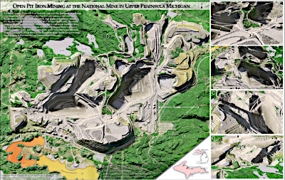
- Geospatial Analysis to work with spatial data to perform analysis and create visual representations of the earth today and in the potential future. Anywhere you see a map on paper on on a computer, there are GIS folks behind it creating and managing the data.
- Cartography for making beautiful maps that clearly communicate spatial information.
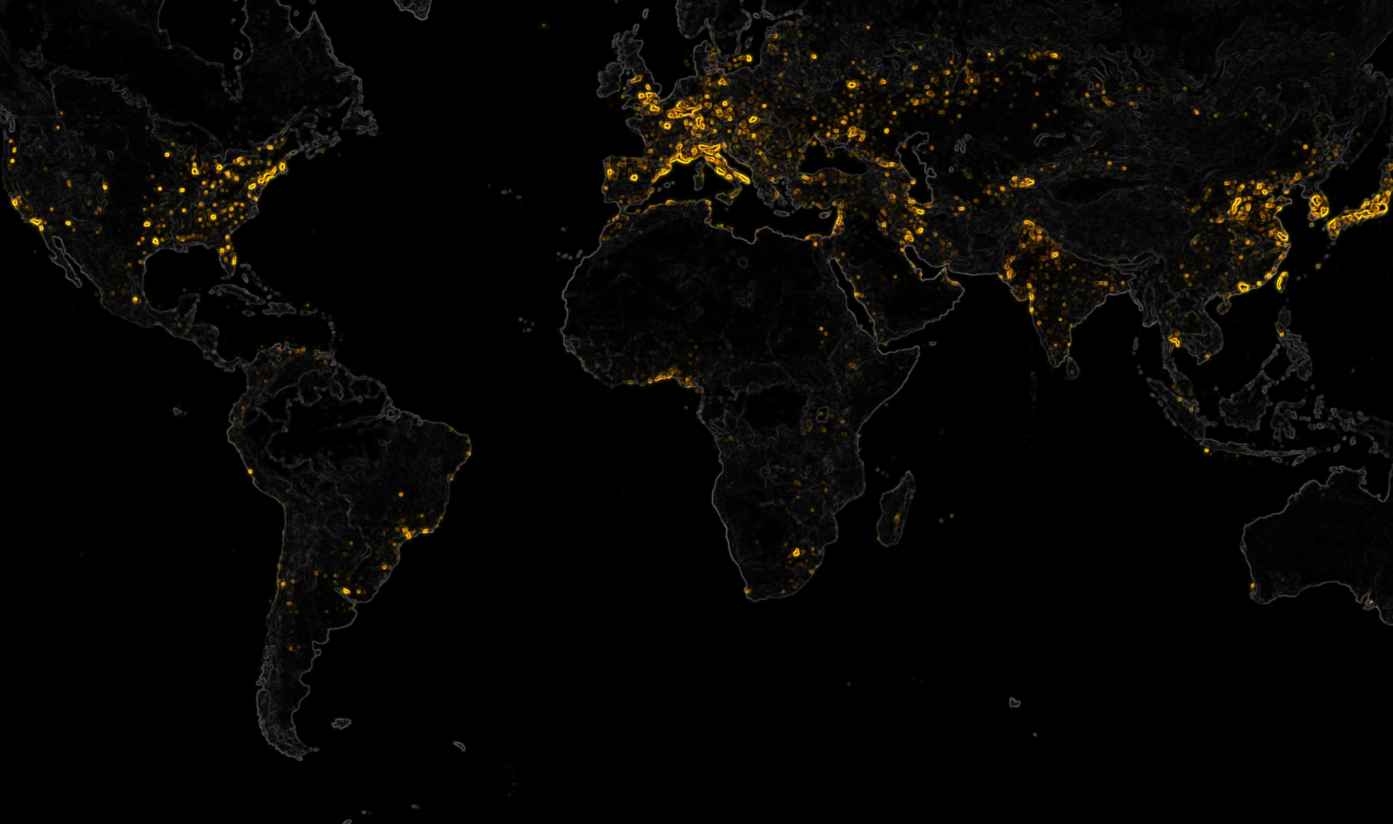
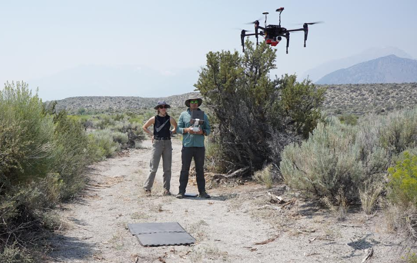
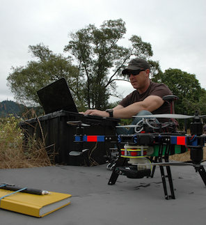
- Remote Sensing takes information from airplanes, satellites, and now UAV’s (drones) to determine the changes our planet is undergoing.
- Mobile Mapping is about going into the field with Geographic Positioning Systems (GPS) and other technology to accurately map the surface of our earth.
Together, these disciplines have created the paper maps, GPS units used in the field and in cars, and all the spatial information you see on smart phones and tablets and computers. Careers in the Geospatial Science have also continued to grow for decades and will continue to grow in the future.
HSU has an amazing GSP curriculum with 15 classes in every aspect of Geospatial Science. You can major in Environmental Science & Management with an option in Geospatial Science , Geography, Environment & Spatial Analysis, or Forestry with a concentration in remote sensing. We also have a Minor Geospatial Analysis, a Geospatial Certificate and an Advanced Geospatial Certificate. HSU is in an amazing location with a complex environment to map and study. Our faculty are up to date on the latest geospatial technologies and methods and are constantly involving undergraduates in their research.
Is a Career in Geospatial Science Right for You?
Geospatial Science students and professionals tend to all be interested in the environment, maps, and don’t mind working on computers. You don’t need strong math skills but some algebra and geometry are important. Some geospatial professionals, like surveyors, spend a lot of time outside, while others spend much of their day working on geospatial analysis on computers.
- Remote Sensing Analysts make about $80,000 per year in the US.
- Cartographers in the US make an average of $66,000 per year.
- Geospatial Analysts, also known as GIS Analysts make an average salary of in the US is $60,000 annually in the US.You can keep your salary growing by becoming a GIS developer ($93,000/year) or manager ($70,000/year).
Meeting the demands of the world today
As the stewards of a planet that provides all means to our existence, we are faced with many choices. Indeed, it is the choices we make today that will determine the condition of our world tomorrow. Yet right and wrong actions are challenging to comprehend in the moment, for often it is time, and time alone, that reveals the true consequence of any decision. In the field of science, many actions of the past, made with good intentions, have resulted in negative consequences over the long term.
Getting Involved
At Cal Poly Humboldt, we are strongly committed to developing every student’s knowledge of the world. While at the same time, we encourage students to discover their true interests and passions. We strive to teach students to see and explore with curiosity, to think critically, and to devise solutions through knowledge and innovation. Through small class sizes and unrivaled one-on-one time with professors, we offer an exceptional learning experience. If you are interested in our geospatial program, please feel free to contact us. We look forward to hearing from you.
Additional Links
Below are links to additional Geospatial resources and organizations here at HSU.
KOSMOS Cartography Lab provides access to the latest technology for students and provides cartography services.
Library GIS Research Guide provides resources to find data, books, maps, and other GIS material.
Projection Explorer Website visualizations of distortion from projections (having some technical difficulties, please come back next week)